An international team of researchers will explore how human occupation and land use over hundreds of years has affected the Brazilian Atlantic Forest – one of the world’s most critically threatened tropical forests.
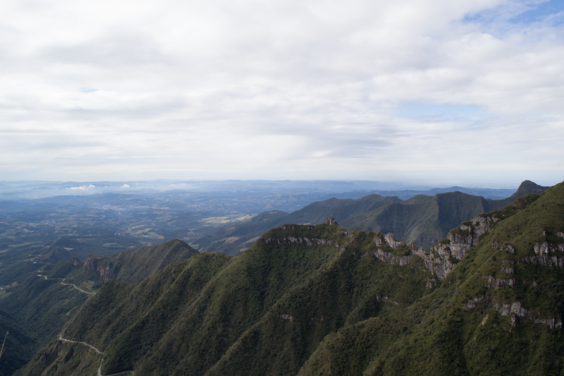
 Santa Catarina in southern Brazil (Photo credit: Philip Riris)
 The research, to be undertaken by teams from Bournemouth University (UK) the University of Göttingen (Germany) and the Max Planck Institute of Geoanthropology (Germany), has been jointly funded by the UK’s Arts and Humanities Research Council (AHRC) and the German Research Foundation (DFG).
Led by Dr Philip Riris from the Institute for the Modelling of Socio-Environmental Transitions (IMSET) at Bournemouth University, the team will use historical, archaeological and ecological data to provide ‘snapshots’ of human activity and its impact on the forest at key points in history.
It is hoped that this ‘atlas of human impact’ will provide useful insights into how the forest has been used and occupied over time, which can inform future protection and conservation efforts.
The Atlantic Forest, which runs along the Eastern coast of Brazil, is one of the most threatened. The forest ecoregion is home to two of the world’s most populous cities - São Paulo and Rio de Janeiro – and produces 70% of Brazil’s gross domestic product (GDP).
The forest – a global biodiversity hotspot - has been heavily impacted by human activity. With an estimated 12 per cent of the original forest area remaining, the Atlantic Forest is now the subject of extensive conservation and restoration efforts.
Dr Riris said: “The forest has been really heavily affected by human activity over the past 500 years and we believe that knowing what to restore, what to conserve and how to best go about it should be predicated on knowing what the condition of the forest was like before it was impacted by industry and deforestation.”
The project will focus on three critical time periods for the Atlantic Forest, which represent major transitions in human activity - Pre-Columbian (before AD 1500), Early Colonial (AD 1500-1700), and Late Colonial (AD 1700-1808).
For the first time in this region, it will bring together existing historical and archaeological records with ancient environmental data – which is captured in lakes and offers an insight into how the landscape and composition of the forest has changed over time.
“We are producing snapshots of the maximum footprint of people in that time and place - the cumulative impact and results at the end of that particular time period,” explained Dr Riris.
“By systematically bringing together this different evidence, we can create what we liken to an atlas of human impact that can be used to inform future efforts.”
Dr Patrick Roberts, leader of the Germany-based team, said: “For the first time in this region, we will seek to build models of past land use based on detailed historical, archaeological, and palaeoenvironmental data, enabling us to ‘map’ changing land use across space and time.”
Dr Riris added: “As the climate changes, the people that live in and around the Atlantic Forest now are going to face increasing ecological and societal precarity. If we can contribute in some small way to understanding how people have shaped their environments in the past, including in a positive way, maybe there's hope for us to do that as well.”


