The rolling chalklands around the headwaters of the River Kennet in north Wiltshire have long been recognized as host to one of the most extensive associated groups of prehistoric sites and monuments in northwest Europe.
Many periods of activity are represented, but especially noteworthy is the great ceremonial centre focused on Avebury Henge that reached its zenith during the third millennia BC, the largest example of its kind in Britain. Avenues of standing stones connect the henge with its wider landscape that also contains Silbury Hill, the West Kennet Palisade Enclosures, several stone circles, and numerous barrows and barrow cemeteries. Since 1986 the area has formed the northern component of the Stonehenge and Avebury and Associated Monuments World Heritage Site (C373), and attracts high levels of visitor attention.
Although many individual monuments have been subject to detailed research, little is known about their full extents, their physical and spatial associations, what was going on in the spaces in between during prehistoric and later times, and how the landscape was structured and used. In part this is because of the scale of the landscape, which extends to 22.5 square kilometres (2250 ha) within the boundaries of the World Heritage Site, and in part because of the general poverty of archaeological techniques that can provide high-resolution results over such large areas.
Geophysical survey provides one possible approach to resolving some of these broader questions, and magnetometry in particular has a proven track record in the area. Improved technologies for the collection and processing of data in recent years provide opportunities to expand the scale and resolution of such work in a way that allows wide areas to be mapped and studied. Accordingly, a programme of extensive geophysical surveys within the Avebury World Heritage Site was started in 2012 by an international research team led by Timothy Darvill (Bournemouth University, UK) and Friedrich Lüth (Deutsches Archäologisches Institut, Berlin, Germany) with assistance and support from Andreas Fischer of Sensys GmbH, Germany, manufacturers of hi-resolution geophysical survey equipment, and Nicola Snashall of the National Trust (Avebury).
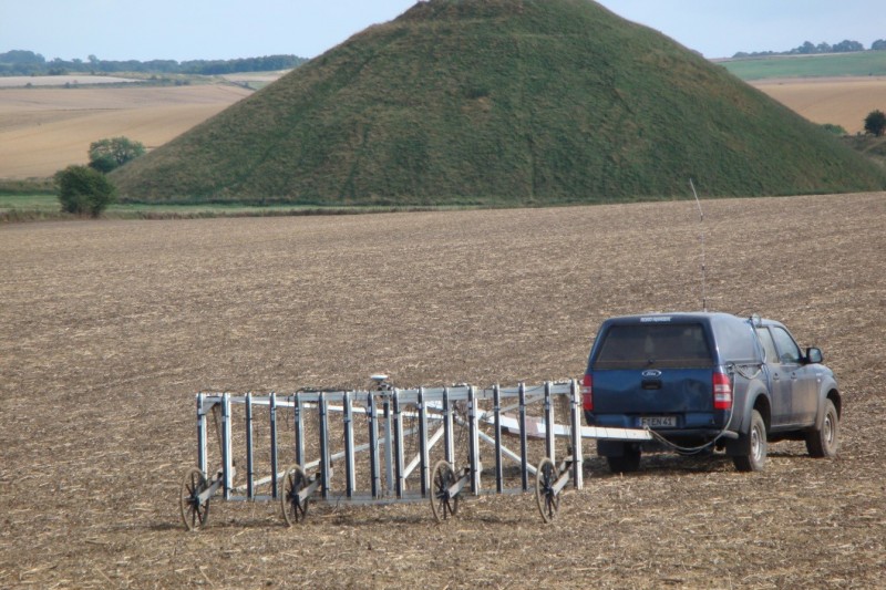
Extensive use is being made of a vehicle-towed multi-sensor gradiometer capable of covering wide areas relatively quickly, thereby offering a solution to the problem of collecting hi-resolution data at the landscape scale. By providing carpet-coverage of the landscape big academically and societally relevant questions can be addressed, such as the social use of space at different times in the past, without resort to imposed categorical binary perspectives such as ‘site’ or ‘off-site’. Geographical and social categories can be explored and visualized as continuums with variable scales and intensities of activity differentially distributed throughout in time and space.
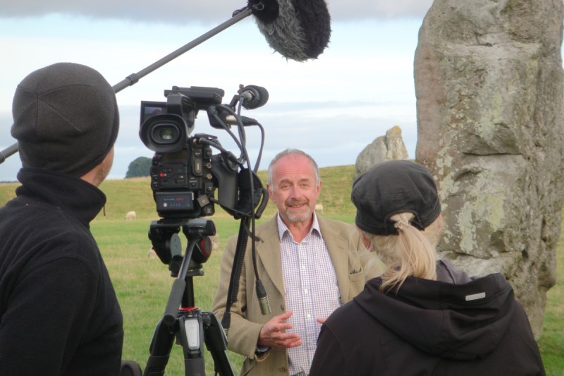
A short film was broadcaster by the German television company Norddeutscher Rundfunk on 26 November 2016 and can be viewed at https://www.daserste.de/information/wissen-kultur/w-wie-wissen/archaeologie-120.html
 Filming at Avebury in 2016
 Surveying in the Avebury landscape: Vehicle-towed 16-sensor array in use on Waden Hill in July 2012

